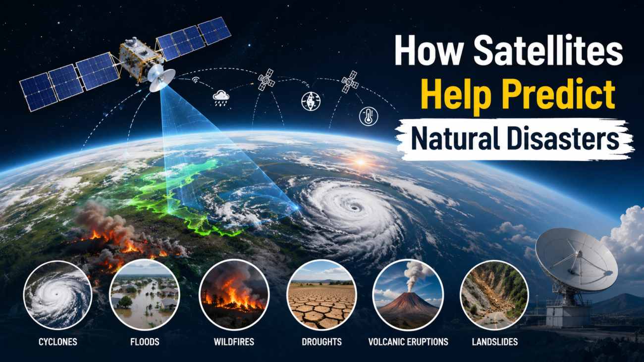
Natural disasters such as hurricanes, floods, earthquakes, wildfires, landslides, droughts, and volcanic eruptions can cause enormous damage to communities, infrastructure, agriculture, and ecosystems. Although many natural disasters cannot be prevented, modern technology has made it possible to monitor environmental changes and provide early warnings that can save lives. One of the most important technologies used for this purpose is satellite observation.
Satellites orbiting Earth continuously collect information about the atmosphere, oceans, land, and changing weather patterns. By analyzing this data, scientists and disaster-management agencies can identify warning signs, track developing threats, and provide valuable information before and during a disaster.
What Are Disaster-Monitoring Satellites?
Disaster-monitoring satellites are spacecraft equipped with specialized sensors and cameras that observe Earth from space. Unlike traditional ground-based monitoring systems, satellites can cover enormous geographical areas, including oceans, mountains, forests, deserts, and remote regions where ground stations may be limited.
These satellites can collect different types of information, including temperature, rainfall, cloud formation, soil moisture, ocean conditions, vegetation health, atmospheric composition, and changes in Earth’s surface.
Some satellites use optical sensors, which capture images similar to photographs. Others use radar, infrared, microwave, or other advanced sensing technologies. These systems allow scientists to observe Earth both during the day and, in many cases, at night or through clouds.
How Satellites Predict Natural Disasters
Satellites do not always “predict” disasters in the sense of knowing exactly when and where an event will happen. Instead, they provide continuous observations that help scientists identify conditions associated with certain hazards.
1. Tracking Hurricanes and Cyclones
Satellites play a major role in monitoring tropical cyclones, hurricanes, and typhoons. Weather satellites continuously observe cloud systems developing over oceans, where traditional weather stations are often sparse.
Satellite images can reveal the size and structure of a storm, while instruments can measure cloud temperatures, atmospheric moisture, wind patterns, and ocean conditions. Scientists use this information to estimate a storm’s intensity, movement, and potential landfall.
This information is particularly important for coastal communities. Early warnings can allow governments to evacuate vulnerable populations, close transportation networks, move emergency equipment, and prepare shelters.
2. Monitoring Flood Risks
Flooding is one of the most common natural hazards around the world. Satellites can help monitor rainfall, river systems, soil moisture, snow cover, and water accumulation.
Weather satellites provide rainfall estimates over large areas, while radar satellites can detect changes in water levels and flooded regions even when clouds block optical cameras.
Satellite-based flood mapping can also help emergency teams understand which roads, bridges, agricultural areas, and settlements have been affected. This allows rescue and relief operations to be organized more effectively.
3. Detecting and Monitoring Wildfires
Satellites are increasingly important in detecting wildfires, particularly in forests and remote areas.
Thermal sensors can identify unusually high temperatures associated with active fires. Satellites can detect hotspots and monitor how fires spread across landscapes. They can also observe smoke plumes and provide information about air quality.
By combining satellite observations with weather data, authorities can better understand the direction in which a wildfire may move. This information can support evacuation decisions and help firefighters prioritize areas requiring immediate attention.
4. Monitoring Droughts
Droughts usually develop more slowly than events such as earthquakes or cyclones, but they can have severe consequences for food production and water supplies.
Satellites can monitor vegetation health, soil moisture, land temperature, rainfall patterns, and water availability. Changes in vegetation visible from space can indicate that crops or natural ecosystems are experiencing water stress.
This information can help governments and agricultural organizations identify drought-affected regions and plan water management, crop protection, and emergency assistance.
5. Observing Volcanic Activity
Volcanic eruptions can sometimes be preceded by changes in a volcano’s surface, temperature, gas emissions, or surrounding environment.
Satellite instruments can detect thermal anomalies, changes in the shape of volcanic mountains, ash clouds, and atmospheric gases released by volcanoes. Radar-based satellites can also measure subtle changes in the Earth’s surface.
These observations can supplement information from ground-based instruments and help scientists monitor volcanoes that are difficult or dangerous to access.
6. Monitoring Landslides
Landslides can occur after heavy rainfall, earthquakes, volcanic activity, or prolonged changes in soil conditions. Satellites equipped with radar technology can detect small movements of the Earth’s surface over time.
By comparing satellite observations collected at different dates, scientists can identify areas where the ground is gradually shifting. Such information can be useful for identifying high-risk slopes and supporting disaster-preparedness efforts.
The Role of Artificial Intelligence in Satellite Disaster Monitoring
The enormous amount of satellite data generated every day would be difficult for humans to analyze manually. This is where artificial intelligence (AI) and machine learning are becoming increasingly valuable.
AI systems can process satellite images and identify patterns associated with floods, wildfires, storms, droughts, and other hazards. Machine-learning models can compare new satellite observations with historical information and detect unusual changes.
For example, AI can analyze satellite imagery to identify flooded areas, burned forests, damaged infrastructure, or changes in vegetation. Combining AI with satellite data can make disaster monitoring faster and more efficient.
However, AI predictions still depend on the quality of the available data and the accuracy of the models. Human scientists and emergency-management experts remain essential for interpreting results and making critical decisions.
Satellites and Early Warning Systems
One of the biggest benefits of satellite technology is its contribution to early warning systems.
An effective early warning system involves more than simply detecting a hazard. Information must be collected, analyzed, communicated, and converted into practical action.
For example, when a cyclone is detected, satellite observations can help meteorologists track its development. Forecast models can then estimate its potential path. Authorities can use these forecasts to issue warnings, prepare emergency services, and evacuate vulnerable communities when necessary.
The earlier accurate information becomes available, the more time people have to prepare.
Satellites Also Help After a Disaster
The role of satellites does not end when a disaster occurs. Satellite imagery is extremely useful for assessing damage after an event.
After a major flood, earthquake, cyclone, wildfire, or volcanic eruption, satellites can provide updated images of affected areas. Emergency agencies can compare these images with older observations to identify damaged buildings, flooded roads, destroyed vegetation, and changes in the landscape.
This information can help rescue teams locate affected communities and assist governments in planning reconstruction and recovery.
Satellite data can also support humanitarian organizations by helping them understand where food, water, medical supplies, and temporary shelters may be needed.
Challenges of Using Satellites for Disaster Prediction
Despite their advantages, satellite-based disaster monitoring has limitations. Satellite systems are expensive to build, launch, operate, and maintain. Some satellite observations may also be affected by clouds, atmospheric conditions, or technical limitations.
Another challenge is data processing. Modern satellites generate enormous quantities of information, requiring powerful computers, reliable communication systems, and skilled experts.
Most importantly, satellites cannot predict every disaster with certainty. Events such as earthquakes remain particularly difficult to forecast precisely. Satellites can monitor changes in Earth’s surface and atmospheric conditions, but they cannot currently provide a guaranteed prediction of when an earthquake will occur.
Therefore, satellite observations work best when combined with ground sensors, weather stations, scientific models, historical records, and local knowledge.
The Future of Satellite-Based Disaster Prediction
The future of disaster monitoring is likely to involve greater cooperation between satellites, AI, supercomputing, drones, ground-based sensors, and communication networks.
New generations of satellites are expected to provide higher-resolution images, faster data delivery, and more frequent observations. Artificial intelligence can help process this information in near real time, potentially improving the speed of disaster detection and response.
Satellite technology may also become increasingly important as climate change contributes to changing patterns of extreme weather, including intense rainfall, heatwaves, droughts, wildfires, and powerful storms.
Conclusion
Satellites have transformed the way humans observe and respond to natural disasters. By continuously monitoring Earth’s atmosphere, oceans, land, and ecosystems, they provide scientists with valuable information about developing hazards.
From tracking cyclones and mapping floods to detecting wildfires, monitoring droughts, observing volcanic activity, and identifying land movement, satellites provide a powerful global perspective that cannot be achieved through ground monitoring alone.
Although satellites cannot prevent natural disasters or predict every event with complete accuracy, they can provide crucial early information that supports preparedness, evacuation, emergency response, and recovery.
As satellite technology, artificial intelligence, and weather forecasting continue to advance, these systems will become even more important in building resilient communities and reducing the human and economic impact of natural disasters. In a world increasingly exposed to environmental risks, observing Earth from space is becoming one of the most valuable tools for protecting life on Earth.

Leave A Comment